
Amazon Awakening
NEW YORK TIMES | Ayahuasca visions and cultural tourism in Ecuador's rain forest.
Photos by: Andy Isaacson
FIRST PUBLISHED IN THE NEW YORK TIMES, OCT. 13, 2010
ILLUMINATED by a single candle, the shaman’s weathered face appeared kindly, like that of a sympathetic doctor, with painted red marks also suggesting a calm, fierce authority — both qualities that I would rely on during the dark and uncertain hours ahead. He sat on a wooden stool carved into a tortoise, and wore turquoise beads around his neck and a crown of crimson feathers. A table beside him displayed the modest tools of the ceremony: a fan of leaves, jungle tobacco, a gourd bowl and a clear plastic soda bottle containing an opaque, brown liquid.
“You will start to feel a reaction in about half an hour,” the shaman, Tsumpa, said, as my guide translated. “When the effects come, you must concentrate on what the medicine is trying to communicate.”
The open air of the hut, animated with night sounds, grew still with expectation. Tsumpa grimaced as he drank the brew. After pouring a bowl for me, he cupped the gourd in his hands and for several minutes whistled a sweet melody into it — the high key of a tin whistle or courting bird, seducing the plant spirits to aid me. The potion tasted acrid and bitter. I rinsed my mouth with water before rolling tobacco into a plantain leaf cigarette.
And then I waited.
It was the final night of my weeklong trip to explore the Ecuadorean rain forest and an indigenous people, the Achuar, who, for more than a decade, have been using limited tourism as a means to preserve and protect their land and way of life. I had traveled by car, plane, boat and foot — more than 100 miles from conventional civilization — to reach a place where the old ways have not been forgotten, where local people interpret the world through their dreams and the forest spirit known as arutam is said to inhabit the mighty kapok tree, and where healing and insight is sought from a hallucinogenic plant brew the Achuar call natem, known elsewhere as ayahuasca, or “vine of the soul.”
The trip was to be a departure from the typical Amazon tourism, which tends to package wildlife viewing with a certain cultural voyeurism. I wanted something more immersive and participatory: an experience with Ecuador’s indigenous people that would expose me to a different orientation altogether. Casting myself into a world that was utterly foreign, I hoped to return with new insight into the familiar.
Earlier in the week — an evening in late spring — I had landed in Quito, Ecuador’s capital, which sprawls at 9,350 feet along the base of an active volcano in a distinctive atmosphere of thin air and diesel fumes that aroused dormant memories of the semester I had spent there during college. With me was David Tucker of the Pachamama Alliance, a San Francisco-based nongovernmental organization that supports the cultural and territorial rights of Ecuador’s indigenous people and operates specialized tours into their homeland.
David had arranged for us to drive early the next morning to the Amazon basin, fly to a remote community that had recently built a small tourist camp in the forest, and then travel by foot and river to a more established lodge. Only despite a long layover, our bags were delayed from Miami — an inauspicious start that would waylay us a day. David thought I might want to experience a “cleansing” from an indigenous Quichua shaman he knew living in the highlands two hours north of Quito, and the next morning hired a car to take us there.
The shaman’s two-floor yellow cement home was modest but the stateliest around. A square altar to Jesus, crammed with crosses and tiny portraits, stood in the waiting room. The shaman, named Don Esteban, emerged wearing a knit V-neck sweater and slacks, beaded necklaces and a yellow-feathered headdress. He beckoned us into the adjacent treatment room, which was sparse and dim and smelled of burnt sugar cane alcohol. I was directed to sit in the corner beside a desk cluttered with melted wax, glass balls, brown eggs and various other mystical paraphernalia.
Don Esteban sat opposite me, next to his wife, a smiling woman with an array of gold teeth. “Here, rub this over your body,” he said, handing me an unlighted candle.
After I did so, he sparked the flame and gazed into it intently. “Andres espiritu, Andres espiritu,” the shaman incanted. “Your spirit is not tranquil. It is sad, and longs for a new energy and path. It is struggling to balance your health, work and body.”
I told him that my father had died two months earlier. “That is why there is sadness and disequilibrium,” he said. “This ceremony, and spending time in the mountains with Pachamama” — Mother Earth — “will help make your spirit whole.”
Don Esteban had me stand naked in the center of the room. Beating a drum and chanting around me, he summoned the ancestral spirits before instructing me to face the four directions of nearby volcanoes in turn, with arms raised, as he blew tobacco smoke on my skin and slapped me with nettle leaves. Then, with his cheeks engorged with alcohol, he held a candle flame to his lips and unleashed spectacular balls of fire that dissipated across my chest.
I looked on these ministrations with skepticism but was left feeling serene, and believing that my visit there had been serendipitous. Whether by intuition or sheer speculation Don Esteban had recognized my grief, and made it a central theme for the journey forward.
Riding back to Quito, I reflected on what the shaman had gone on to say. Three times, he had placed rose petals sprinkled with floral water into my palms, and told me to rub them all over from head to toe. “Andres,” he said all the while, “open your heart.” When we arrived at the hotel that night, our bags from Miami were awaiting.
The five-hour drive east from Quito into the Amazon basin passes through a highland corridor known as the Avenue of the Volcanoes. Pichincha, Cotopaxi, Antisana, Illiniza — their snow-white peaks rise above Ecuador’s fertile central valley like giants, and Andean indigenous people humanize them as such, relating to them as elder family members who hold great influence. This can sometimes be very handy: I was told of a pregnant young girl who dealt with her father’s disapproval by blaming the cause on the Imbabura volcano. Who was he to argue?
Our flight into the jungle was to leave from Shell, a one-street frontier town on the edge of the Amazon basin that was established by the Shell oil company in the 1930s as a base for prospecting. After 20 years, Shell left and evangelical Christians moved in — embarking on their own kind of prospecting from the town’s small airport. (They’re still there.) But when we arrived, flights were grounded because of rain. We were told to return the next day; David suggested we drive to nearby Puyo, the provincial capital, and meet some Achuar leaders.
Numbering around 6,000 on an ancestral territory of nearly two million acres in southeastern Ecuador, the Achuar people were among the last of the country’s rain forest tribes to be contacted by outsiders, when some Salesian Catholic missionaries arrived in the 1960s. Elders say that in the early ‘90s they began having dreams about an imminent threat coming from the external world. Soon after, they learned that the western edge of their homeland had been given over to Arco as an oil concession.
Most of Ecuador’s estimated 4.7 billion barrels in crude oil reserves — the third largest in South America — lie under the northeast Amazon region, where foreign corporations have left a legacy of pollution and displacement that has been widely decried.
But the Achuar had watched watching northern tribes struggle against oil companies, and beginning in 1991 were able to organize their scattered — and historically warring — communities into a political entity that has so far saved them from a similar fate.
Recognizing a need for outside allies, they met with a group of Americans to form the Pachamama Alliance, which for the last 15 years has helped the Achuar and other Amazonian indigenous groups from its Quito office with land titling, skills training, economic development and policy advocacy.
With proponents of oil development — including Ecuador’s president — continuing to press for exploration on their land, the Achuar now find themselves embroiled in a classic struggle for power and resources that native people have almost always lost.
We found Chumpi Tsamarin (also known as Luis Vargas) who had been the Achuar’s first president, seated inside the restaurant he opened on a side street in Puyo. Mr. Tsamarin, who has also led the political organization representing all nine of Ecuador’s Amazonian indigenous groups, described the current territorial struggle in terms of psychological warfare (he saw “Avatar” as an affirmation of their cause, but thought the violent tactics depicted in the film were not inevitable); the Achuar, he said, feel staunchly resolute about their right to defend what is theirs. As they see it, our collective survival is imperiled by the modern “dream,” as he put it, that sees nature as an endless fount of resources.
So far, Mr. Tsamarin said, tourism has presented the most viable, nonpolluting source of economic security. In 1996, the Achuar opened Kapawi Lodge & Reserve, which receives an average of 1,000 visitors a year. Last month the United Nations named it one of the top five outstanding environmental conservation and community development projects in the world. Though the lodge was initially set up in joint partnership with an Ecuadorean tour company, the Achuar have assumed full ownership. Most of its 30 staff members are natives, and some received hotel management training in Quito.
But the benefits of tourism have a corollary, and Mr. Tsamarin lamented them: the loss of communal values and a new market mentality, alcohol abuse, litter, men cutting off their traditional ponytails. The Achuar now want to expand a controlled form of tourism farther into their territory, and have built a camp in the forest near the remote community of Tiinkias to offer visitors a more rustic experience than Kapawi. I would be the first tourist there.
After spending a night at the luxuriant El Jardín Hotel in Puyo, we were cleared for takeoff the next afternoon in a small Cessna operated by Aerotsentsak, the Achuar’s aviation service. From on high the metaphor of the Amazon as earth’s lung came to life: below us, wispy clouds lingered over the virgin forest as vaporous exhalations while mocha-colored rivers coursed through it like capillaries.
After an hour, we landed at a dirt airstrip beside Chichirat, a forested settlement of 10 families north of Tiinkias.
I immediately felt transported by the absence of mechanical ambience, as though the soothing sounds of nature were reaching me through noise-canceling headphones. David and I stepped off the plane as dozens of villagers stared at us quizzically, and a man with a round face and thin mustache walked forward, introducing himself warmly as Shakai. He would be our guide. As children carried off our bags, Shakai led us into the elliptical communal house built over the dirt with a high palm-thatched roof and open walls, and divided along gender lines. Males sat on benches around the perimeter; women clustered in the back.
In short order, I was handed a red clay bowl painted with blackand-white shapes, filled with the staple brew of sweet fermented manioc called nijiamanch. A performance began: a woman walked up to me and sang shyly in Achuar about a sunny day alone in the forest, when she missed her husband, but was comforted knowing that he was somewhere witnessing the same sun. In a fragile falsetto, a young man with a long ponytail voiced words meant to ward off a bad omen he received. I was handed a drum and told to meander around beating it, to the amusement of all, while a girl hopped erratically beside me in a kind of courtship dance.
Their unpolished performance was touching, and being the first ever for a tourist gave it the feeling of historical significance. But this also troubled me, as I considered how my arrival marked the ushering of changes that Mr. Tsamarin had described. And yet there’s this unexpected upside. Such quaint cultural displays meant to satisfy tourists expecting something “authentic” and exotic can also resuscitate and revive aspects of traditional culture. “It makes us see how we’re admired and validates the importance of our traditions,” Mr. Tsamarin had told me, adding that the Achuar now consider the value of their cultural heritage as a useful leverage against oil development.
It became too late to travel on to Tiinkias, so we ate dinner — a crispy heliconia leaf stuffed with steaming wild turkey, palm hearts and green onion — in the thatched house of the local shaman, and pitched tents on the wooden floor of the schoolhouse.
That night I dreamed of my mother and father defending the rain forest, and later, of Ben Stiller announcing a televised ski race in an Afro wig. When I awoke at 4 a.m., roosters were already declaring it daytime through the pitch darkness. The Achuar typically rise at this transitional hour to drink guayusa, a caffeinated tea grown in the forest. It is a time when fathers pass on values to their children, mothers teach skills to their daughters and dreams are interpreted.
The local shaman, Jippeikit, told me that my first dream was about my father wanting to reunite with my mother — “Even when we die, our souls still exist,” he said. The skiing dream, he sensed, was a story of competition, which boded well. “When you visit another area,” he said, “you will not have any problems.”
We reached Tiinkias after a short trek through the muggy forest and a motorized canoe ride downriver. Its two dozen inhabitants were awaiting us in the communal house, beside a dirt clearing with a volleyball net woven from plant fibers. Laundry hung to dry between thatched-roof dwellings. An uneven footbridge spanned part of a small lagoon where a caiman rested on a log.
Over two idyllic days I found myself content simply in the Achuar’s mellow presence. We spent hours in the communal house drinking nijiamanch, tended by women constantly squeezing the pulp by hand. Often, some story I couldn’t understand provoked fits of laughter. I sang a bluegrass gospel number for the Achuar; David played guitar. Each morning, I had my dreams read by an elder.
We slept in the new tourist camp, built on a forested knoll just outside the settlement, with a simple layout of elevated wooden platforms covered by thatched roofs that extend into eating and sleeping areas meant to accommodate the groups of up to 16 visitors they anticipate.
Shakai became not just my guide to the forest but also its interpreter. In a nondescript leafy plant he saw a remedy for gastritis; in an electric blue morpho butterfly that fluttered erratically past, he saw the ears of a deceased ancestor. “What does a stick bug represent?” I wondered aloud. Shakai said it was just a stick bug.
One afternoon we passed a kapok tree, 150 feet tall with splayed buttresses and thick, weeping vines, which Shakai explained as a home of arutam: the spirit of the forest, and ancestors.
When Shakai was 13, he said, like all Achuar boys, he ventured into the forest alone to find arutam. For three days prior he fasted. He then laid a seat of palm leaves beneath a kapok tree and prepared the sacred forest medicines: datura and natem, hallucinogens that produce potent visions. Arutam first arrived, the Achuar believe, in a form of strength: a jaguar, or sometimes an anaconda, or lightning. If one becomes afraid, it is said, arutam disappears. But move toward it courageously, and the vision is supposed to transform into an elder ancestor, who reveals one’s life calling.
During this rite of passage, Shakai saw himself working with outsiders he’d never seen before. When Kapawi Lodge was built many years later, Shakai would become one of its first guides.
We reached Kapawi by motoring down the Bobonaza River, up the wide Pastaza, to the Capahuari — a four-hour journey that dipped us briefly into Peruvian territory. The lodge is set on a sheltered lagoon; 18 palm-thatched bungalows, built on stilts above the shallow water in traditional Achuar style — without nails, but with modern comforts like solar-heated showers and eco-friendly flush toilets — are connected with airy dining and lounging areas by an elevated boardwalk. The lagoon behaves as a town plaza for bird life, and screened back walls and shaded balconies ensure that guests are always well positioned, from bed or hammock, to observe its lively happenings.
It was the low season, and we and a German couple were Kapawi’s only guests. Visitors typically fly in from Shell on four-, five- or eight day packages of standard jungle lodge fare: dugout canoe rides, guided forest walks, and spotting animals (Kapawi’s remote location within a protected reserve offers a particularly excellent chance of that). Riding back the next morning from a clay lick enjoyed by chestnut-fronted macaws, we came across pink river dolphins. Later we paddled a canoe looking for anaconda but returned satisfied by yellow-rumped caciques nesting beside hoatzins, a prehistoric-looking, pheasant-sized bird with a spiky mohawk. Alone on Kapawi’s self-guided trail one afternoon, I startled (I should say the reaction was mutual) 30 ring-tailed coatis, which leaped onto tree limbs and then fixed me with beady stares.
But Kapawi places an emphasis on cultural activities, and guests can learn how women make nijiamanch or spend a night in a local Achuar community. Lodge staff members can also arrange participation in a dream-sharing ceremony with guayusa tea. But through a local shaman who knew and trusted David and Shakai, I received a special invitation to drink natem, which is how I landed, on that final evening, in Tsumpa’s house.
Tsumpa and his wife, along with a dozen children and grandchildren, live by themselves high above the Pastaza River on a tidy clearing ringed by coconut palms, manioc plants, fruit trees and a garden of various plant medicines. It was dusk when we arrived; in the distance, isolated cumulonimbus thunderclouds were set aflame by the pink-orange sun. Tsumpa was seated within a bucolic tableau: his sturdy wife prepared bowls of nijiamanch and tended to chores, while one daughter sat on a bamboo platform breast-feeding and another wove a headband. Dogs napped on cold ashes; an orphaned, saddlebacked tamarind monkey hopped onto a bunch of plantains; a toucan perched on a nearby log.
Tsumpa served me the natem in an adjacent hut. All appeared normal, until after what seemed like 20 minutes it no longer did. A montage of images emerged from the darkness — neon crystals, a lion. Soon my body dissolved into the surroundings, swallowed by a sea of energy. Unmoored and disoriented, I was adrift in a more expansive reality.
This brought a greater awareness, and I began to perceive things that had been imperceptible, like a low-frequency vibration permeating the environment. The hum of the universe? My thoughts drifted between visions. I imagined myself basking in the sun on the flanks of the volcano Chimborazo. I saw images from childhood and of random friends back home, all presented like scenes from the narrative of my life. Then my father appeared, seated in a chair before me, like a ghost. For several minutes we exchanged the sentiments that I had regretted not expressing before he died: What a life we shared, we both seemed to say. I looked down and noticed I was sobbing, and when I looked back up, he was gone.
Tsumpa was whistling and shaking leaves around a sick baby that had been brought to him for a cleansing, and Shakai asked if I’d like the same. I sat before Tsumpa and felt his hands on the crown of my head. His whistling seemed to conjure a protective field; in the leaves fanning my shoulders, I sensed a dusting of energy.
“Look at the stars,” Shakai said. The night was alive and glorious. Stepping outside felt like entering a larger room, the constellations stretching overhead as a low-hanging ceiling. David noticed my lingering sniffles and offered a bowl of tobacco-infused water, a traditional remedy, to clear my nose. Snorting it triggered a surge of intense sensation and then violent waves of vomiting unlike any I had ever experienced. More bizarre were the accompanying sounds: primeval bellows so loud and resonant they seemed to echo for miles. After, I could hear Tsumpa’s daughters giggling, and soon we were all laughing.
I laid myself down on a palm leaf, spent and contented. David and I chatted into the night. The Achuar conversed in their huts. Babies cried and were hushed. A gunshot went off in the forest, the sound of a lone man hunting. Within this dynamic nightscape, the boundaries between waking and sleeping, between inside and outside — indeed between humans and nature — blurred to nothing.
I awoke refreshed after a few hours of sleep, no longer feeling the queasiness that had been bothering me for two days. Sipping a coconut from Tsumpa’s tree, I asked the shaman what he had noticed in me.
“Andres,” he said simply, “You came here to learn about the culture, the rain forest and reality of the Achuar people. Now you’ve seen that.”
David and I returned to Quito later that morning and parted ways. I had given myself a few more days in Ecuador without a plan, but now I knew where to go. I traveled south through the highlands to Riobamba, and then ascended to Estrellas de Chimborazo, a cozy mountain lodge set beneath Ecuador’s highest peak, “Father” Chimborazo — some say that elevated by the equatorial bulge, it reaches closer to the stars than any spot on Earth.
I took walks alone through the surrounding páramo, the bushy, blond grassland carpeting the volcano’s flanks, past grazing alpacas, and lay for hours on my back.
It was precisely the time with Pachamama that Don Esteban had prescribed for me. And as I had envisioned myself.
Pamir Mountains, the Crossroads of History
NEW YORK TIMES | Retracing the Silk Road through Tajikistan.
FIRST PUBLISHED IN THE NEW YORK TIMES, DEC. 17, 2009
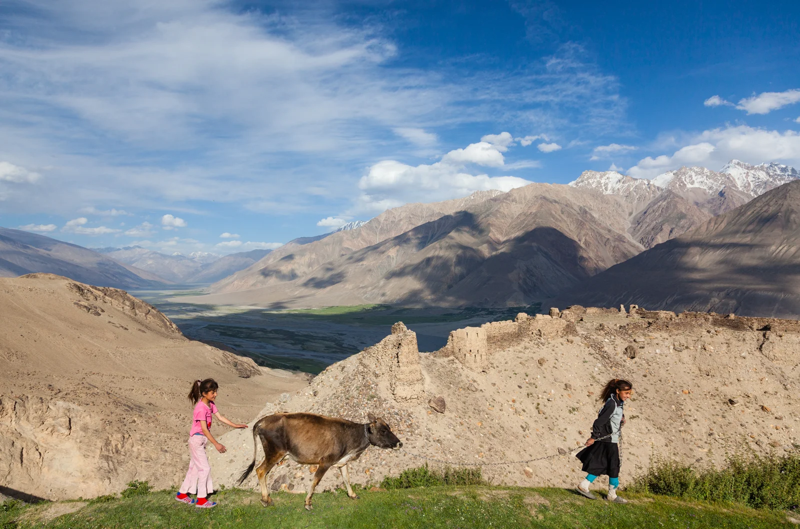
BY 9 IN THE MORNING, the bazaar on a rocky island in the Panj River was a frenetic scene of haggling and theatrics. Afghan traders in long tunics and vests hawked teas, toiletries and rubber slippers. Turbaned fortune tellers bent over ornate Persian texts, predicting futures for the price of a dollar. Tajik women bargained over resplendent bolts of fabric. All were mingling this bright Saturday at a weekly market held throughout the year and, in one form or another, for thousands of years here in the Wakhan Valley, which divides Tajikistan and Afghanistan.
“Mousetraps, mousetraps, mousetraps, oooowww!” crooned a white-bearded Afghan in the Iranian language spoken by locals from both sides of the border.
“They don’t buy!” complained a high-heeled shoe salesman from Kabul to me, in English.
“They always start the price too high,” a Tajik woman in a blue patterned dress and headscarf whispered as she stood before bright red carpets, appearing seductive against a monochrome mountain backdrop.
As the sun rose higher, I joined the crowds — young Tajik men in sporty shirts and jeans, uniformed border guards, families — seeking shade under rainbow umbrellas to eat rice palov, served from large cauldrons. Across the market grounds, I could see three lipsticked Korean women in straw hats dispensing balloon animals to a captivated group of men and boys.
East meeting West, North meeting South: since time immemorial, the Wakhan Valley, in the Pamir Mountains, has existed at the intersection of trails trodden by nomads, peddlers, pilgrims and, at times, the soldiers and emissaries of great powers. When I’d thought about traveling to see this rugged branch of the ancient Silk Road, it had seemed like an adventure to the far-flung periphery of the world. Now, as I looked around the market, taking the long view of history, it felt more like the center.
During the last century, this long-strategic nexus of Asia, earlier crossed by Scythians, Persians, Greeks, Kushans, Hephtalites, Gokturks, Huns, Arabs and Mongol hordes, became a cul-de-sac at the command of the Russians. In 1929 Stalin’s mapmakers created the Soviet Socialist Republic of Tajikistan, a territory about the same size as New York State, 93 percent mountainous, given shape in the artificial (though politically expedient) manner in which all the Central Asian republics were drawn. A Soviet vision of a model Oriental capital was built around the market village of Dushanbe — pleasant and leafy, if dull, with a wide central avenue, pastel-colored buildings, the standard apartment blocks and some grand monuments meant to be honored from afar. (Make the innocent mistake of approaching one, as I did, and you give an underpaid policeman an excuse to seek a bribe to overlook the offense.)
The Soviets brought universal education and health care, but banned the Persian alphabet, erasing Tajiks’ literary history, and outlawed the practice of Islam. At independence in 1991, Moscow left behind an impoverished and fractured country that soon plunged into a bloody civil war. Tajikistan emerged in 1997 corrupt but safe, ailing but reasonably stable. Before long, foreign tourists began to trickle in.
After the three legs of my flight from New York, armed with a visa and special permit to visit the Pamir region, I arrived in Dushanbe during a stifling week last July. The Russians gave the city a rail link west to Uzbekistan, and they paved a road east, toward Kyrgyzstan, that is known today as the Pamir Highway and increasingly draws foreign mountain bikers and motorcyclists.
“Highway” is a generous classification for it. It took me 20 hours to travel the dusty 325-mile stretch from Dushanbe to the provincial center of Khorog in a shared taxi, flat-tire breaks included. The road climbs over craggy, treeless mountains and falls into tidy villages with apricot trees. It is interrupted by several checkpoints, including one in a valley through which heroin and opium are trafficked — and to which, news reports say, militants have begun returning — north from Afghanistan.
At this checkpoint, a burly man wearing fatigues and a Harley-Davidson hat introduced himself as Muhammad Ali, asked for my bag, and called for the dog. Out came a small, floppy-eared lapdog that agents practically had to drag over to sniff my backpack. “He must be starving,” Muhammad Ali joked. “Just open the bag.” I was sent on my way, wondering if those were my tax dollars at work. Last year the United States spent $1.7 million to counter narcotics in Tajikistan.
KHOROG, a relaxed town of 28,000 in the heart of the western Pamirs, sits across the Panj River from Afghanistan. Its isolation largely spared it from the civil war of the 1990s, but a humanitarian crisis crippled the area after Soviet handouts came to an end. A savior came in the form of a descendant of the Prophet Muhammad himself, the Aga Khan, a Swiss-born businessman who owns racehorses and a yacht club on Sardinia and is the spiritual leader of the Ismaili Muslim sect to which most Pamiri people have belonged for a thousand years. The community-supported charitable organization over which he presides, the Aga Khan Development Network, resuscitated Khorog, which now has two universities, new construction and a young, optimistic population.
Winters can be long and raw, but in summer the balmy air, rustling fruit trees and pedestrian bridges spanning a jade river make Khorog a nice base for exploring the Pamirs. Through an agency, I had arranged to meet a driver and translator there to guide me for a week, first south to the Wakhan Valley and then through it to Murghab, a town in the eastern Pamirs. We would sleep at a network of homestays.
The next morning we set out in a former Russian Army jeep, leaving the Pamir Highway to head south on a paved road along the Panj River, which defines much of Tajikistan’s 830-mile border with Afghanistan. Brown, gravelly slopes rise steeply from the river toward snow-capped peaks beyond view. The rustic adobe homes and donkey trails that I could see on the opposite, Afghan bank seemed suspended in a different time.
The Pamir region was renowned in antiquity for its rubies (technically, spinel) and lapis lazuli. The most famous mine, Kuh-i-Lal — though closed to the public — came into view above the road. It was the source, I later learned, of the 170-carat Black Prince’s Ruby now in the Imperial State Crown of Britain.
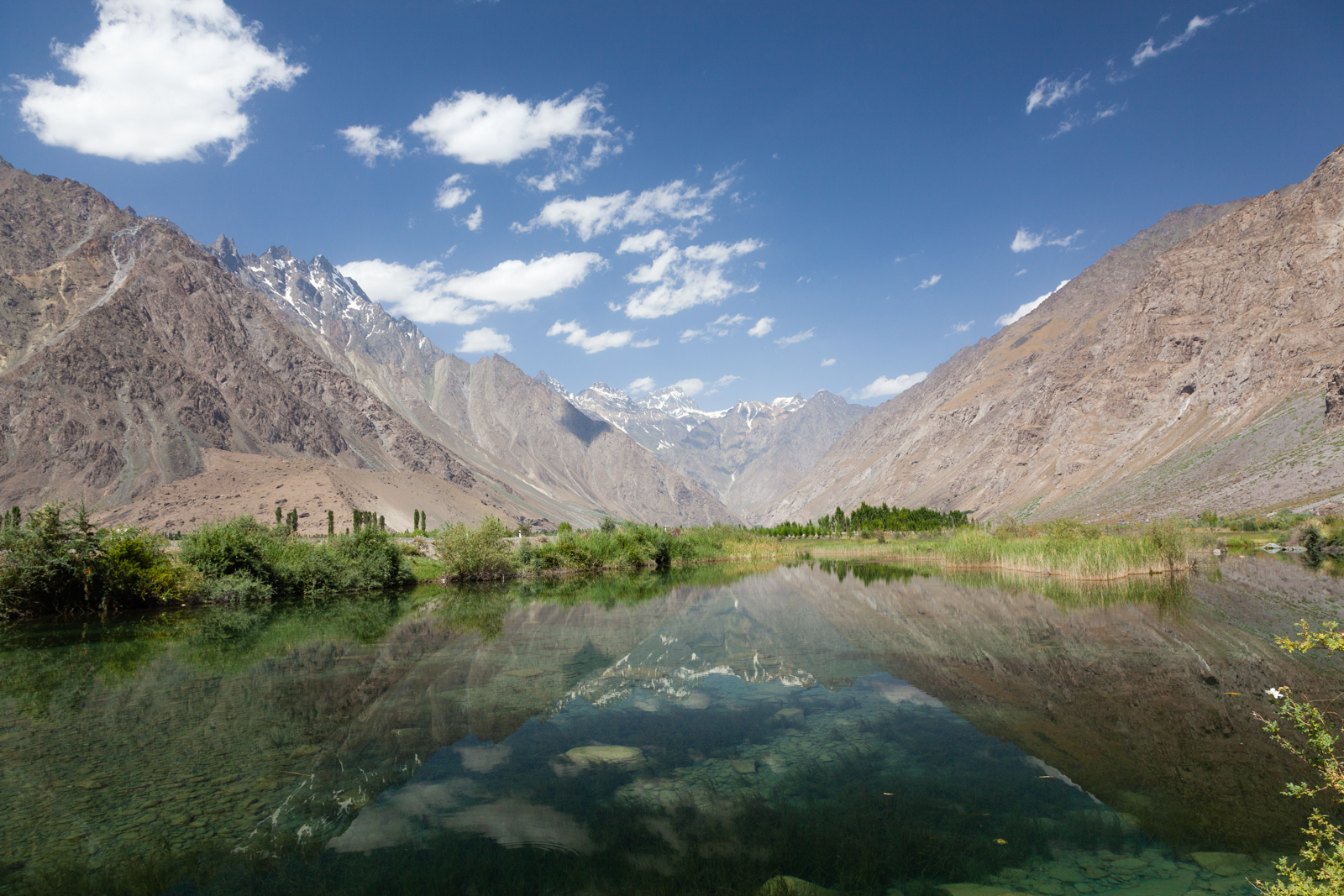
At a turn, the white crowns of the Hindu Kush appeared, and we entered the 85-mile-long Wakhan Valley, a fertile quilt of wheat fields along the Panj River, “situated among the snowy mountains,” as the seventh-century Chinese Buddhist pilgrim Xuanzang described it.
I arrived at the Saturday bazaar, with its mousetraps and fortune-telling, by 9 a.m. and stayed until the island began to empty, in early afternoon. I talked with a blue-eyed Afghan policeman sporting Bushnell binoculars and a Leatherman toolkit and later passed a Tajik boy wearing a cap that read “Berkeley, Califopnia.” He reacted indifferently after I explained that I actually came from there. I realized that such sights are probably no more remarkable today than, say, a Chinese visitor here in the sixth century encountering Italians in silk shirts, or a Sogdian seen with the latest gadgets from the army of Alexander the Great, who crossed the Panj River in 329 B.C. At this ancient intersection, surreal juxtapositions of globalization date back for millenniums.
In the town of Ishkashim, adjacent to the market, we visited the crumbling remains of a sixth-century caravansary — an ancient motel for Silk Road travelers. Then we drove on eastward in the Wakhan Valley, passing roadside shelters decorated in pebbled mosaics conveying messages of Soviet propaganda, until we reached the remnants of a sprawling stone fortress occupying a prominent rock above the Panj. A plaque in Tajik and English explained that this was the King’s Castle, constructed in the third century B.C. by the Siah-Posh, a tribe of black-robed fire-worshipers (probably Zoroastrian), to defend the Wakhan from intruders.
I followed the small footpaths meandering among the ruins and thought of Samarkand, the fabled Silk Road oasis in Uzbekistan whose restoration has stripped much of its character, and Kashgar, China, overrun by modern Han society. The contrasting authenticity — and fragility — around me here was reflected on a plaque: “Your responsible treatment of the sites during your visiting them is appreciated as your contribution to the preservation of historical monuments.”
I spent two days exploring the detritus of history littered across the Wakhan Valley: rocks with Arabic inscriptions, petroglyphs, imposing fortresses, stones that were once arranged to determine the spring solstice and hot springs rumored to boost female fertility (I was the only man visiting these).
Small shrines to Ismaili holy men line the roadside. Each has its own legend, and is ornamented with special stones and curled ibex and sheep horns, symbols of purity under Aryan and Zoroastrian religious traditions, which predate Islam in the region.
Men, women and children strolled up and down the road between their villages and wheat fields. I offered lifts to old ladies in colorful embroidered skullcaps who showed gratitude by touching my chin and kissing their hands.
In a village called Yamg, we turned in where a sign announced a museum, and a teenager named Nasim opened the building with a key. The museum is in the home of his distant ancestor Muboraki Wakhani, Nasim explained, a little-known mystic poet, musician, astronomer and prolific Ismaili scholar of the late 19th century. Inside, artifacts from the ages were displayed, none behind glass: a tattered gold-and-blue imam’s robe, purportedly from the 12th century; 15th-century Chinese copper kettles; clay jugs from the storied Uzbek city of Bukhara; pipes, knives and yak horn cups; Stone Age beads; wooden stringed instruments carved into crude human figures.
Nasim invited me to his family’s house for lunch, and we followed him down a dirt pathway. Wheat, apricots, mulberries and dung lay on the flat roof to dry. The stone-and-plaster architecture was typical of traditional homes throughout the Pamirs, rich in symbolism that includes elements of ancient Aryan and Buddhist philosophy. For Ismailis living here, the home is itself a symbol of the universe and serves instead of a mosque as a place for prayer.
Nasim’s father, Aydar, mustached and wearing a track suit, led me into a main room divided, according to tradition, into three areas signifying the kingdoms of nature: animal, vegetable and mineral. Five supporting pillars represented the five members of the family of the prophet Muhammad and his son-in-law Ali: the one for Muhammad, left of the entrance, is traditionally where a newborn’s cradle is placed and where newly married couples sleep.
Light beamed in through a skylight framed by four concentric square wood layers, representing earth, water, air and fire. Under it Aydar’s daughter laid a spread of raisins, peanuts and berries, potato and corn soup, fresh round flatbread and salty milk tea, which is passed and received with one hand to the heart. As Marco Polo noted, the language in the Wakhan Valley is different even from the Iranian dialects spoken in other Pamir valleys. But Aydar spoke some English and Russian, which was translated for me. I asked him how long his family had lived here.
Aydar told of a legend about a hotheaded emir in the 15th century who killed an entire family save one boy, who fled north, married and had three sons. One son returned to the valley years later, and eventually the two others followed with their families; these were Aydar’s ancestors. The dates were vague, but I was awed by a family story that began 600 years ago.
After lunch, we continued on to the nearby village of Vrang, where children were tending sheep below a tiered stone stupa built on a rocky perch by sixth-century Buddhists. “Buddha, Buddha,” Somon, a local boy, said, cupping his hands in a pantomime of meditation. He volunteered to guide me up to the stupa’s ancient rocks. I sat there looking at sunset over the Pamir crest, coloring the valley from on high like light slanting through clerestory windows, at moonrise above the Hindu Kush — and at Somon, who was eager to climb down. “Homestay?” he asked sweetly, pointing to a faintly lighted house in the birches below. I followed him there.
“Having left this place, and traveled three days, always among mountains,” a man “ascends to a district which is said to be the highest in the world,” Marco Polo reported 700 years ago, describing the climb north from the Wakhan Valley to the 13,000-foot-high desert plateau in the eastern Pamir from which several major ranges — the Himalaya, Karakorum, Hindu Kush, Kunlun and Tien Shan — fan out across Asia. The same journey took us three hours in our temperamental jeep, passing Stone Age petroglyphs, a lone Soviet watchtower, two Swiss mountain bikers and (across a tributary of the Panj, demarcating the border) Afghan traders leading a caravan of double-humped Bactrian camels.
“Along this high plain, which is called Pamier, he sees neither habitation nor verdure,” Polo went on, and until late in the Soviet period, the majority Kyrgyz population that endures this extreme realm known to early Persians as the Roof of the World remained mostly nomadic. The few permanent settlements today have a weathered, frontier character: tin roofs, rusty vehicle parts, satellite dishes.
We rejoined the Pamir Highway in the Alichur Valley, a 40-mile-long thin grass steppe ringed by low, rounded mountains, where Kyrgyz families come to graze their animals, setting up summer yurt camps. “Authentic” would only lamely describe the timeless, pastoral serenity of this place, or suggest the bliss I felt on my first star-filled night there reclining on hand-woven carpets by a warm iron stove inside a yurt, dipping bread into freshly churned yak butter, listening to Kyrgyz spoken in hushed tones.
Farther east, at Besh Gumbez, we visited the domed ruins of a caravansary and later passed a caravan of Chinese trucks laden with inexpensive household goods, parked beside the road. The drivers, Uighurs from Kashgar bound for Dushanbe, crouched in the shade beside the tires with a propane tank and a box of peppers, preparing lunch. In antiquity the caravans carried exotic luxuries like silk, jade, porcelain, furs, dyes, tea and spices; what a different sense the phrase “made in China” evokes today.
We split off the Pamir Highway and spent the next four days bouncing across a stark moonscape on jeep tracks that connect remote shepherd camps. One morning we saw a family out in the open air near their adobe home, rolling damp, matted wool into felt for the walls of a yurt. Curd balls lay drying on the roof. The grandfather, Mamajan, wearing a cardigan sweater and knitted skullcap, invited me for steamed meat dumplings and tea.
“Are there places like this in America?” he asked in Russian, waving around at the craggy, mineral-stained earth.
“Yes, a place called Nevada,” I replied.
“Come inside.”
Mamajan filled and refilled cups of green tea as we dabbed warm flatbread into bowls of butter and fresh yogurt. His grandparents were from present-day Kyrgyzstan. They were rich, he said, before the Soviets took their sheep. Mamajan was a bookkeeper during the Soviet period. He switched back to farming after independence and sells wool and meat, and dung for winter fuel.
By the age of 19, Mamajan claimed, he already had nine children. “You’re 32?” he asked me. “Why aren’t you married?” No explanation I could offer would suffice.
“ALL kinds of animals abound,” Marco Polo noted here, “in particular, a species of sheep with horns of three, four, and even six palms long. The horns are heaped up in large quantities along the road, for the purpose of guiding travelers during winter.” They still are, but the world’s largest sheep — named after Polo — is now endangered. I encounter only traces: their footpaths and magnificent skulls, strewn eerily across the barren landscape. Foreign hunters, mostly American, pay $25,000 to bag one. We passed a hunting camp that is temporarily closed so that sheep numbers can rebound.
My last homestay, on the far side of Tajikistan, was at an isolated yurt pitched on the edge of an expansive valley facing a spectacular panorama of the serrated Wakhan Range, in Afghanistan. Beyond lay Pakistan and just east of me, over a lofty pass, China. There, six years earlier, on a trip across that country, I had stayed in a similar yurt with Kyrgyz hosts and was left to imagine what existed across the border. I now stitched the two experiences, years apart, into a single panoramic image.
It was here in the Pamirs where Russia’s territorial expansion confronted Britain’s defense of India during the 19th-century geopolitical rivalry known as the Great Game. Both sides dispatched players — maverick officers and ambitious explorers, often in disguise — to chart Central Asia’s wild terrain and win influence. A final flashpoint occurred over the mountain in front of me, where in August 1891 a British agent crossed paths with his Russian counterpart, who claimed it as the czar’s and threatened arrest. Four years later the powers agreed to make that narrow valley between their empires — the Wakhan Corridor — a buffer belonging to neither, and it is still part of Afghanistan, a panhandlelike eastward salient of little importance.
The Great Game came and went, part of the historical tides weathered forever here, in the romantic heart of Asia. I could hear the enduring pulse of that heart around me in the whistling wind and the calls of children corralling the sheep for the evening.
“Andy, come,” my host hollered from the yurt. “Dinner is ready.”
Bartang Valley, Tajikistan. Credit: Andy Isaacson

Just Me and My RV
NEW YORK TIMES | A western road trip to the world's largest RV rally.
FIRST PUBLISHED IN THE NEW YORK TIMES, MAY 18, 2012
I HAVE SPENT THE NIGHT in a Walmart parking lot. I have driven through a national park with a trail of cars in my rearview mirror. I have learned how to dispose of my waste through a plastic hose, and I have filled my gas tank more times in one week than I thought was possible.
But this is to be expected when you’re driving a small studio apartment, or, as I began to call it, my “rig.” One man in a rural California border town even called it cute. He said it reminded him of a Doritos delivery truck.
The rig was a 19-foot-long, gleaming white, class-C motor home — an RV that I rented from Cruise America, the country’s largest recreational vehicle rental company; 800-RV-4RENT was prominently emblazoned across the exterior, as were colorful images of America’s national parks and natural patrimony.
It was a proverbial flag patch sewn on a backpack, and as someone who makes an effort to downplay the fact that I’m a tourist when I travel, this granted no disguise. And just as well: I had never driven an RV before, and for this I could say I had never experienced my own country as millions do every summer, and have for more than a century.
When I booked the RV online a couple of months earlier, I found myself signing up for not so much a mode of transportation as a set of desirable feelings. “With a Cruise America RV,” the Web site said, “you can roam wherever your spirit takes you, throughout the US and Canada. And with a full kitchen in your RV, you can skip out on endless drive-through menus and enjoy more satisfying meals and snacks.” Roam, spirit, satisfying meals: these are not the sort of words used to tout a rental car or an airplane seat. An RV road trip promised the distinction of freedom and flexibility, comfort and convenience: a travel experience unencumbered by the need for reservations.
I enlisted my friends Tyson and Angelina, and we mapped a vague plan: Oakland, Calif., to Oregon and back, in eight days. We’d go where we wanted to go, when we wanted to go. We’d tour less-visited national parks and rural towns and sleep wherever it suited us.
RVers constitute a certain tribe on the road, and I learned that thousands were converging in central Oregon for what was billed as the Greatest RV Rally in the World. On a July afternoon, after receiving instructions in the Cruise America parking lot on how to check the RV’s water levels and empty the waste tank, we headed off on Interstate 80.
Packing for an RV road trip is like preparing for a weekend at a cozy cabin. The luxury of space and the semblance of domestic life inspired me to carry things like candles and paprika, soft cotton sheets and extra pillows. I took sharp knives, folding chairs and musical instruments and put avocados and lemons in a bowl on the kitchenette counter. We hung up our coats in the closet, with hangers. As I drove the rig, Tyson and Angelina put away groceries.
A compact RV drives like a van, but its bulky size soon altered my personality behind the wheel. I paid close attention to the yellow speed advisory signs for a change, and I rarely switched lanes, feeling unusually content to cruise in a patient, linear fashion. (Abrupt turns would cause the drawers and cabinets to fly open, anyway, prompting a scramble for rolling onions.) From a higher perch the landscape appeared wider, more available. Once we joined Interstate 5 in California’s Central Valley I began to feel a closer kinship with the truckers on the road, especially that first evening, after we pulled into a Walmart.
OF all the things Walmart is best known for (low prices, litigation, the demise of mom-and-pop stores), an overnight stopping place for RVers is not among them. But drive any evening into a Walmart lot along a busy highway, and you’ll probably find parked motor homes.
RVers often spend weeks on the road: that road is long, and there are many Walmarts along the way. As the company sees it, RVs arrive with their own bathrooms, and their drivers are well positioned to shop: everybody’s happy. Searching online from my phone I learned there were three Walmarts staggered along 30 miles of Interstate 5 in Northern California.
Around sunset, I checked in, so to speak, at the store in Red Bluff. There was plenty of vacancy. Another motor home rolled into the lot after me; its driver, a middle-aged man, placed a footstool outside the side door and made himself at home. He told me he was a semipermanent resident there and commuted to a local community college. “I just came from the gym,” he said.
It was still early, so my friends and I patronized our host: I bought a power inverter while they picked up flip-flops and bottled water. We cooked dinner on the RV’s gas burners, and set up lawn chairs on the asphalt. All night long, the glowing Walmart sign flooded the motor home like pale rays of moonlight.
In the morning we branched east on Highway 44 into the volcanic foothills of the southern Cascade Range. The fertile single-crop fields of the Central Valley transitioned to a forest of spindly firs and pines and pumice rock. In Shingletown, Calif., I spotted a hand-painted sign: “Great Food. Bakery. RVs OK.” It began to dawn on me how the world not only looks different from the seat of a big vehicle, it also treats you differently because of this.
We also needed less from the world. Traveling with our own toilet, mini-mart and motel room left us open to make unessential pit stops with little concern for time. We could roam.
Down the road an eccentric roadside carpentry workshop caught my attention: “Paul Bunyan. Holiday Log Style Gifts, World’s Best Bird Houses, Benches, Teepees and More.” I pulled over and found a tall man holding a chain saw, wearing a hard hat and overalls with an American flag lapel pin on the strap. He introduced himself as Steven Pelloza, “a k a Paul Bunyan, and I certainly live up to that. We’re the Paul Bunyan Conservation Society.”
This was a pro-timber environmental group, Mr. Pelloza explained. “We clean the forest and build products, like the world’s greatest birdhouse, which that is,” he said, pointing to one carved out of pine, with two little holes. We chatted a bit longer about the area, and he told me stories about being a logger in southeast Alaska, after the Exxon Valdez spill. (“Truckloads of money. Total bonanza.”) As I made to leave, he reached for a birdhouse. “Here,” he said. “You take this one.”
The native Modoc people once called California’s sparse northeast corner “the Smiles of God.” Then in 1915, the area seemed to incur God’s wrath with the eruption of Lassen Peak, which blanketed the surrounding high desert in volcanic ash. One county’s official slogan today is “Where the West still lives,” although the area’s history is laid bare in boarded-up places like Uncle Runts Watering Hole, in Old Station, and abandoned homesteads.
Hardscrabble frontier life seems not to have eroded a sense of whimsy; the sidewalks in Alturas, a town near the Oregon border, are lined with stores like the Belligerent Duck (an outdoor outfitter); Skirts N Spurs (a hair salon); and Classy Lassie (an apparel shop). We passed signs on front lawns that read: “Land of the Free Because of the Brave.” Outside the Adin Supply Company (since 1906), in the town of Adin, we were advised: “Starbucks is 70 Miles Away. Our Coffee Will Get You There.”
Nearly every town seemed to have its resident hoarder with an antiques and collectibles shop. “Some people can’t come in,” said Sally B, a self-described “hard-core junkie” who owned Just Stuff, in New Pine Creek, Ore. “They just stick their head in and walk out. But others just get consumed by it.” As did my friends: Tyson, a musician, found an antique toy piano; Angelina walked out with a black leather jacket and beret.

Just Stuff in New Pine Creek, Ore. Credit: Andy Isaacson
Our meandering had taken us past dark, so we parked for the night by a stream a few miles up a national forest road.
RVs have long been bound up in the American myth of freedom and mobility and independence, with allusions to the covered wagon, that symbol of the Western frontier.
Recreational vehicles (which include motor homes, fifth-wheel trailers, folding camping trailers, travel trailers, truck campers and sports utility RVs) date back to the Model T. In 1922, The New York Times estimated that of 10.8 million cars then on the road, 5 million would be used for motor camping. Initially these “auto campers” just attached tents and other supplies to the outside of their vehicles, but eventually a few craftier individuals were affixing platforms to support canvas tents.
Solid-sided tents were built with cabinetry and wardrobes and also kitchens. Later, in the 1920s, commercial manufacturers began mounting “camp bodies” over auto chassis. During the dry years of Prohibition, even Anheuser-Busch built RVs, advertising in the pages of Field & Stream magazine.
As the towing capacity of automobiles increased, so did the size of house trailers, which by the late 1930s contained built-in iceboxes, kitchen ranges and flushing toilets. Some even had front-mounted airplane-style propellers to drive a wind-powered generator.

Courtesy of AAA California
Recreational vehicles promised to make vacations easier and cheaper. “ ‘Home Sweet Home’ Wherever You Roam,” claimed a 1936 brochure for the Kozy Coach trailer. “Is there anything finer than ‘to get away from it all’ now and then? Out on the water. Hunting through the woods. Tramping over the hills, or just lolling under the open sky. That’s the life!”
Early auto campers were derided as “Gypsies,” “trailer trash” or “tin-can tourists.” In the winter of 1919, a group of 22 families parked their jerry-built mobile shelters at Desoto Auto Park, near Tampa, the first public campground in Florida, and founded the Tin Can Tourists of America, a fraternity of RVers that by 1935 had swelled to some 300,000 members.
Today there are many RV clubs and, of course, blogs. Some cater to specific RV brands, like the Wally Byam Caravan Club, for Airstream owners, founded in 1955, with 5,600 loyal members today. Others are for certain RV lifestyles, like Escapees, a club for “full timers.”
The Greatest RV Rally in the World, which is held three times a year in different parts of the country, was taking place on expo grounds on the outskirts of Redmond, Ore., and was put on by the Good Sam Club, the world’s largest RV club, with 870,000 member families. My friends and I arrived just as the 1960s crooner Bobby Vinton took to the main stage as the evening’s entertainment.
In the registration building, attendees had decorated a map of the United States with pins over their hometowns, which spanned from Hawaii and Alaska to the border town of Pharr, Tex. One RV came from Homestead, at the southern tip of Florida, a 3,191-mile drive away. A yellow Post-it affixed off the Eastern Seaboard read: Germany.
I splurged on a parking site with full electrical and sewage hookup. Many of the 2,500 rigs, sprawled across the sagebrush like a marina of yachts, had American and state flags flapping overhead, or fake flowers in vases that rested on artificial grass rugs beside the front door. Address placards hung in the windows, like “Grammy and Grumpy’s Motorhome.” One motor home in particular caught my eye, possibly the most gaudy vehicle in the lot — or the most awesome: a 45-foot, black-and-tan Country Coach Veranda 400, tricked out with a glass-walled outdoor deck that came off the side of the living room.
I found its owner, Steve Collins of Atkins, Iowa, perched on a leather bar stool on the deck wearing fuzzy bear-paw slippers and sipping a beer. A baseball game played on a 42-inch flat-screen television. The rig was a stunning McMansion on wheels. On the ground beside the motor home lay three electric skateboards, a golf cart, a remote-controlled toy helicopter and a plastic Nascar racer, all of which fit into spacious storage bays below the RV. “I feel like the luckiest guy in the world,” he said, offering me a bottle of Bud. “I’m in awe every time I look at it.”
Mr. Collins said he and his wife leave their RV parked beside their home, behind its own remote-controlled gate. Every so often they take to the road, packing their two Great Danes and a flock of parakeets, which Mrs. Collins had advertised for sale on a lawn chair. When they drive up to a convenience store, kids will ask Mr. Collins if he’s a musician on tour, which flatters him. The RV had a vanity license plate that spelled TOYZILLA. Mr. Collins explained that his wife wanted IGOTMINE, but he didn’t want people hating on him. “My first choice was PRIAPISM,” he said.
The rally featured nightly entertainment, including the country singer Vince Gill (“Howdy campers! Although RVing isn’t really camping.”) and Herman’s Hermits, the 1960s British invasion rock group. Before that show, I joined 1,798 of the rally’s 6,500 attendees in attempting — and, we believed, setting — the Guinness World Record for most simultaneous high-fives (it turns out that a group in Norway had bested the record a couple of weeks earlier).
I also attended a dog show one morning in a tent on the expo grounds. “The doggie swimsuit competition is up first, so get those suits on,” the M.C. announced to kick it off. “If anyone needs a cleanup bag, they’re behind the stage.” More than a dozen RV owners trotted out their pooches, colorfully outfitted in swim caps, plastic sunglasses, bikini bottoms and, in one case, nothing save a red paper crown and sign that read: Nude Beach Queen 2011.
“We’ve got some real canine bathing beauties here, let me tell you,” the M.C. noted. To a soundtrack of Paul Anka’s “Puppy Love,” a black Labrador passed before me in a pink polka-dot one-piece and swimming goggles, followed by a bichon wearing the retired Speedos of his master. There was a fluffy black poodle with pink toenails. Giggles filled the tent after one contestant in the “Double Vision” category (a dog/owner look-alike contest) introduced his pet Chihuahua shepherd. “I know what you all are thinking,” the M.C. said. “Chihuahua-shepherd sex is pretty funny.”
RV rallies have always been about both camaraderie and merchandising, and there were serious deals to be made at the Greatest RV Rally in the World. Vendors hawked RVs, RV awnings, satellite TV packages and concealed-weapons permits, and there were seminars, too, like “Green RVing” (not an oxymoron) and “Feel Better and Keep Energized While on Road” (drink green tea and exercise).
I met a retired couple from Maryland who were heading north to the Columbia River Gorge in Washington after the event. From there, they said, they would just head “wherever the wind blew.” A full-timer from Michigan told me how friends often ask how she could sell her house for a life on the road. “It’s just stuff,” she said. “The way we look at it, we’re home wherever we are.” I may have been one of the younger attendees at the rally, by about 30 years, and probably the only RV driver with a rental, but all this made sense to me. These were travelers inclined to roam, in the words of Cruise America, wherever their spirits took them.
AFTER three days at the rally, my friends and I blew westerly into the Cascades, passing by Crater Lake National Park, which was the magnificent blue hole in the earth that I’d always imagined. Friends had told me about undeveloped hot springs on national forest land down the road. I pulled into a gravel parking lot, beside an outhouse, with the sign: “NUDITY. Nude bathing is common at Umpqua Hot Springs. If this makes you uncomfortable, we recommend you not go into the area.”
Next to my rig was parked a 1966 cream-colored, vegetable-oil-powered Gillis school bus, towing a yellow VW van. Its passengers were milling about. One woman, with yellow dreadlocks, wore a quilted skirt made of leather scraps and a coyote tail. I asked the group where they were headed.
“We’re all Gypsies,” replied one man. “We don’t move on until we get moved on.” Another, who had “I may be lost but I’m Makin good time” scrawled on his pants, said he’d “been from where the wind blows since 1998.”
Their driver was a longhair named Manny, who told me that he’d just picked the others up at the annual Rainbow Gathering, in Washington State. Manny wore frayed overalls and a Grateful Dead shirt under a brown hoodie. His bus had a Family Coach Motorhome Association placard affixed to it, which I’d seen on many RVs at the rally. Just as my mind began to grapple with the cognitive dissonance of holding Manny in the same company as retirees at a Bobby Vinton concert, he said he was also a life member of the Good Sam Club.
“But they kicked me out of one of their campgrounds,” he said nonchalantly. “They said: ‘Your bus is too old. Other campers won’t want to camp beside it.’ Whatever.”
Umpqua attracted the kind of people prone to detour down the side road. Tubs were carved from the rock on a steep riverbank overlooking the misty hemlock forest. In one sat a Japanese family, wearing modest bathing suits. In another tub I chatted with a couple on their way home from a Kinetic Sculpture Race (a contest of human-powered amphibious sculptures) on the Oregon coast. As night fell, a group of neo-pagan women nearby, who had just met at a “summer witch camp” in southern Oregon, sang hymns.
HARVEST HOSTS is the name of a new program that allows RVers to stay free overnight at wineries and farms across the country. (As at the bakery in Shingletown, RVs are O.K., but cars in this case are not.) The annual membership fee is $35, and joining gave me access to a network of hosts, which is how I arrived the next evening at Hillcrest Bonded Winery 44, in nearby Roseburg.
The proprietor and winemaker Dyson DeMara was casual and welcoming. He poured us lovely wines; Hillcrest is one of Oregon’s oldest estate wineries, home to the state’s first pinot noir vines.
He then pointed out a grassy patch beside the tasting room where we could park the rig for the night. Next to it was a stone fire pit stocked with wood. “It’s in the spirit of wine,” Mr. DeMara told me when I asked how he’d become a volunteer host. “In the New World it’s a business, but in the Old World, wine is an open-your-doors kind of thing.”
We drove back across the California border and joined Highway 101 in Crescent City. There I spotted a man on a street corner slumped against a stop sign with a cane, thumbing it. The rig had room and he looked harmless, so I offered him a ride.
His name was Dan. He was 61, a former trucker from North Carolina, and spoke with a polite drawl. He was hitching his way down the coast, taking it as it came. A year earlier, Dan said, he was hospitalized after striking a deer on his Harley. Doctors gave him a short time to live, but he kept living, and figured he’d been dealt a second life. He jumped on a bus going west to Seattle.
Dan was roaming in the manner of Manny and his band of neo-hippie “Gypsies,” just like the Good Sam Club RVers and the Tin Can Tourists a century before them. My rig had brought me a similar freedom: something in which to wander “wherever your spirit takes you,” without reservations. An endless drive-through menu, after all.

Riding the Rails
NEW YORK TIMES | From New York to California by Amtrak.
FIRST PUBLISHED IN THE NEW YORK TIMES, MARCH 8, 2009
SOMEWHERE on the west side of Illinois, the Amish men broke out a deck of Skip-Bo cards and I joined them as the cafe car attendant, using an iPod and a set of portable speakers, broadcast Eckhart Tolle, author of “A New Earth,” discoursing on the virtues of stillness.
“Life gets discombobulating,” the attendant said, calmly. “This helps.”
On both sides of the train window, American scenery unfolded. A dirty layer of ice and snow subdued the still cropland to the distant horizon. At the next table a woman stuck her nose in a novel; a college kid pecked at a laptop. Overlaying all this, a soundtrack: choo-k-choo-k-choo-k-choo-k-choo-k — the metronomic rhythm of an Amtrak train rolling down the line to California, a sound that called to mind an old camera reel moving frames of images along a linear track, telling a story.
The six Amish men were in their mid-20s, and they were returning home to Kalona, Iowa, after a three-week cross-country tour. They had especially liked the Creation Museum, in Petersburg, Ky., and Niagara Falls. As we rolled across white plains, they pointed out which plots grew beans and which grew corn. To my eye, the dormant land revealed few clues.
Around the train car lounged Americans traveling for work and others for family, people for whom train travel is a necessity and those for whom it’s merely quaint, first-time riders and probably even a few “foamers” — the nickname that train workers privately give the buffs who salivate over the sight of a locomotive.
I had ridden long-distance trains in India and China but never across my own country. I suppose that after two years of receiving images saturated in red, white and blue from all corners of the nation, I wanted to make my own. The fading glow of the Inauguration, I thought — a moment for national unity and new beginning, both imagined and real — would be a good light in which to meet the country again. And it was winter, after all; I didn’t feel like driving.
With every uptick in gas prices, Americans in general are thinking less about driving. With each degree of global warming, trains become even more sensible. And with each new surcharge and each new item of clothing one is required to remove to board an airplane — and with every small-town commercial airport and cabin amenity that vanishes forever — the rails beckon. Last year, Amtrak set all-time ridership records.
Traveling cross-country by train takes time, but less than I expected: within four days, one crosses the Hudson River and reaches San Francisco Bay at Emeryville, Calif. I gave myself a week, stopping in Chicago, Denver and, for variety, a remote town in Nevada that had a nice ring to its name.
THE Amtrak Cardinal rolled out of New York’s Pennsylvania Station slightly before dawn on a frigid January morning. I had booked a roomette — a cozy compartment just larger than a Japanese capsule that converts from two facing seats into bunk beds. The attendant asked if I wanted a wake-up call the next morning, pointed out the showers down the hall and said that breakfast would be served after Trenton.
The roomette’s décor — blue curtains, a (sealed) metal ashtray on the armrest — evoked the era of Pan Am. On the upholstered seats rested two hangers, two pillows and a crisp copy of The New York Times, which on that morning featured a photo of the ex-Illinois governor, Rod Blagojevich, projecting an image of false calm. Chicago, all aboard.
On a two-dimensional map, the crosshatched lines that represent railroad tracks resemble stitches binding patches of textured fabric. Essentially, these remnants of America’s rail network predate 1910, and unless you’re on it, you scarcely notice it — crossing under our freeways, passing through once-thriving rural towns that today’s highways avoid. We consider train tracks indifferently, the way we do electricity wires: as behind-the-scenes infrastructure, a ubiquitous but background feature of our landscape.
At least this is how it seemed en route to Washington, as the train rolled past unkempt backyards and graffitied factory walls, icy ball fields and the back doors of crumbling buildings. America presents itself to the streets; the tracks take in a less manicured backside. How refreshing a sight.
Our consumer society may still rely on trains to transport things, but those things are pitched to drivers in cars, not to passengers on trains. And so, as early as New Jersey, I realized something that would only feel remarkable a few days later, in the Nevada desert: it’s still possible to travel 3,585 miles across the United States without being the target of billboards, golden arches or absurdly large twine balls. The rails offer a view onto Unbranded America — the land as it was.
The Cardinal makes 31 stops in 27 hours on a southerly, U-shaped path from New York to Chicago. It’s not the most direct of Amtrak’s routes, but it charts a course through textbook American history: Baltimore; Washington; Manassas, Va.; Cincinnati.
At Philadelphia, a woman named Mary Ellen Phillips Belcher and her grown daughter Ladonna settled into the roomette across from mine. They were returning home to Kentucky after visiting a relative in suburban Pennsylvania. They usually drive; the train ride was satisfying a long-held curiosity.
Life stories and first names have a way of surfacing between strangers. Mary Ellen lived her girlhood days in Junction City, Ky., with four brothers and a single mom, along the old Louisville and Nashville Railroad tracks.
“We didn’t have money to buy cigarettes, so we’d get us a coffee can and collect the butts thrown off the train,” she said. “Mother would always leave a skillet of cornbread and brown beans outside the house for the hobos coming through. Evidently, they had passed word on to their friends that Mother was a kind lady. She’d never have enough food for us, but she’d always have something for somebody.”
“I said, ‘One of these days I’m going to ride a train to remember Mother and those hobos’ ” she told me, in way that moved me. “I guess I had to be 65 before I took that ’venture.”
Behind her, Washington’s monuments drifted slowly across the glass, and as we passed the Capitol, I imagined a bureaucrat inside considering what to do about Amtrak. As a quasi-public rail service, Amtrak stays afloat with a little more than $1 billion a year from the federal government. Last September, for the first time since 1997, Congress approved an Amtrak authorization bill that could nearly double it. The stimulus package President Obama signed in February includes $8 billion for high-speed and intercity rail projects, and one would think that so long as “Amtrak Joe” Biden holds high office, trains will continue to get some love.
After Charlottesville, Va., I planted myself in the lounge car, which divides the coach and sleeper cars and serves the social function of the train’s town square or neighborhood pub — an egalitarian place for conversation and chips.
“D’ya see that doe?” a man from Virginia asked me, pointing outside. “Still as can be.”
I was curious about whether he hunted. He laughed and said, “Don’t need to now; my boy does it for me.”
A man nearby overheard and chuckled. “I used to,” he said, “before I started huntin’ the two-legged kind.”
“I wish they had a gambling car.”
“At least they got beer.”
“Uh-huh.”
Along the tracks, a tranquil scene of rolling farmland speckled with horses eventually became steep slopes of forest in a haze of swirling flurries. I asked the two men if these were the Allegheny Mountains.
“Outside of here, they call them the Appalaychians,” one of the men told me. “We call them the Appalaachians. Hell, I just call them swampy, wooded-ass areas.”
Meals on board are white-tableclothed affairs; however, these days the $22 flat iron steaks are served on plastic replicas of Amtrak’s former china. Passengers are seated together. For dinner, I enjoyed my cheese ravioli across from an Amish man from Minnesota who was escorting his wife home from hernia surgery in South Carolina. (Many Amish are uninsured, he told me, and some take trains to Mexico for less costly medical care.)
After he finished, one of the attendants — not the 27-year veteran with eyebrows painted red-and-blue Amtrak stripes and a customized “Amtrak” belt buckle sparkling with bling, but the other — seated a couple from suburbanColorado. He was a retired defense contractor; she, a former Delta flight attendant.
“The food’s better here,” she said, a remark I took as authoritative. Cutting into her baked potato, she added, “You couldn’t get this on a plane.”
By the time we rolled into Ashland, Ky., at 11 p.m., the temperature had plummeted enough to freeze the track switch, waylaying us at the platform for two hours. I passed the time in the lounge car with four other travelers, all quick to make acquaintance. One, from the Bronx, was seeking a football coaching job in Arizona; another, from Indiana, had just visited relatives in Virginia.
Every so often, someone would look at a watch and feign complaint. But really, it was half-hearted; on a long-distance train, it seems, the fluid movement across space induces a surrender to the natural unfolding of time.
At some hour during a fitful sleep, the heat in my roomette stopped working. The attendant call button didn’t work, either. I froze until morning. Even if mine was an aging, government-subsidized room on wheels, I wondered whether after paying more than $200 for that night, it wasn’t reasonable to have certain expectations.
Before it was possible to travel across the troposphere, nearly all cross-country journeys passed through Chicago. I spent a night in the city, and the next afternoon boarded the California Zephyr.
New relationships quickly formed in the observation car, which on the double-decker, Airstream-like Zephyr was outfitted with curved glass walls and padded chairs. Passengers lounged together, sharing snacks or packed beverages, and making commentary as the landscape — cold metal silos, lonely farmhouses on windswept plots — passed across the great picture window in high definition.
Under streaks of pink and orange, we crossed the icy Mississippi River on an old steel bridge. Dozens of bald eagles, pointed out by the conductor in an announcement, perched on the western bank, presumably fishing. We rumbled along the main streets of small but once prosperous Iowa towns and glimpsed architectural treasures like Omaha’s former Union and Burlington train stations, which are now, sadly but symbolically, a museum and a condo development.
We were making good time, which is not a reputation Amtrak usually enjoys. Seventy percent of Amtrak’s service — basically everywhere but in the Northeast — operates on freight railroad tracks, where inefficiencies cause frequent delays. According to federal law, but not always in practice, passenger trains have priority. Two years ago, Union Pacific agreed to reduce the speed restrictions it imposes on Amtrak trains while it does track maintenance, but a Department of Transportation report last September said that little had changed.
Conductors told me it has, some. But for now, the crippling economy has significantly lessened freight traffic across the country. One conductor told me that he trades stocks based on looking out the window; when he sees less freight, he sells.
So owing in part to the recession, we coasted at dawn — ahead of schedule — into Union Station in Denver, where a friend picked me up for a quick drive into the mountains for a day of skiing. It felt good to jump off the train: even with utter freedom to move about the cabin and an onboard minimart, the mind and body, before long, yearn for solid ground.
After riding my own set of metal edges through ankle-high powder, I slept across from the station at the upscale Oxford Hotel. In this 1891 institution, I could briefly reimagine the romance of cross-country rail travel (and where, as an Amtrak passenger, I got a special $150 rate, compared with $210).
In the morning, I boarded another westbound Zephyr. Leaving Denver, the rails snake through 29 tunnels on their ascent into the Rockies. In a single bend, we turned from the great brown plains, and the dominant impression of America — which 2,000 miles east had been industrial and, later, agricultural — suddenly turned geological.
We passed old mines and mountain ranges, red rock canyons and ranches blanketed by snow, glistening under the winter sun. For hundreds of miles, the train coursed along icy green stretches of the Colorado River accessible only by raft or rail.
Vacationers heading for resorts debarked at the Glenwood Springs and Fraser-Winter Park stations, and a man who had introduced himself as Oscar — a Mexican migrant from North Carolina — got off at Grand Junction to pursue a restaurant job.
I sat with Steve Nykorchuk, a man from Pittsfield, Mass., with a scraggly gray beard and cane, who rides from Albany to Reno five times a year to play the penny slots. Before every trip, his 90-year-old mother slips him an envelope with spending money, and every time he feels bad about taking it. When he arrives in Reno, people say, “Here comes the Train Man.”
“I come so often they know exactly what beer I’m drinking,” he said. “That’s funny, to come 3,000 miles and people know what you’re drinking.”
As Colorado’s majesty faded into the Utah night, I drank coffee with Ben Kinsinger, a kindly, 63-year-old Amish butcher from Lancaster, Pa. Every February, he and his wife ride to the country’s warmer climes. In Phoenix, they visit the airport to watch planes take off and land, and on the train he likes to chat with passengers, like me, who never visit Lancaster. I was touched watching him connect with a young couple from Nepal.
Credit: Andy Isaacson
“No electricity, stitching clothes — wow!” the Nepalese girl said. “That would be like giving up everything, like a nun.”
On the way to the dining car the next morning, Ben patted me. “The cows are milked, the horses are fed,” he said, jokingly. “It’s time for breakfast!”
But instead, I got off the train in Winnemucca, Nev., a small town dwarfed by big sky and high mountain desert. And for no particular reason, really. (“We don’t usually get many Winnemuccas,” the conductor said as I got off.) But train routes are about connecting — and appreciating — the points in between, the country’s negative spaces, those places that urban dwellers might deride as “middle of nowhere.”
A century ago, Basque sheepherders jumped off at Winnemucca by the hundreds, and that evening, I had Picon Punches and lamb shank with their descendants at the 110-year-old Martin Hotel, a wooden bar and restaurant beside the tracks with scrapbook-lined walls and a small claim to still being a boardinghouse — a retired man named Phil occupied a room upstairs.
Today, many of the Basque work for gold mines outside town. The flow of Picon Punches follows the price of gold, and these days, both are up. I slept the night at a cheap motel after playing a penny slot at Winners Casino, and caught the next Zephyr rolling through.
In dawn’s light, the train streaked across the Great Basin Desert, blurring the view of tufted yellow shrubs flanking the rails but framing the white-dusted, mineral-stained mountains beyond in an unfolding panorama across the observation car windows. Choo-k-choo-k-choo-k-choo-k-choo-k: that hypnotic rhythm and empty Nevada landscape stilled the mind to a slow, meandering drift. I looked around the observation car to see four other passengers sitting silently; a fifth gazed out the window, picking his guitar.
In Reno, a dozen gamblers boarded, and we climbed to the Sierra Nevada pass named after the hapless westbound journeyers who ate some of their own to last the winter of 1846. Forty years later, the Donner Party would have had a transcontinental train. The Zephyr’s engineer made steady, giant slalom turns along that original route, weaving through the snowy backcountry on a 7,000-foot descent toward the shining sea.
Docents from the California State Railroad Museum in Sacramento, who regularly ride the train back and forth to Reno, filled in the passing scenery with history. Chinese laborers, they told us, forged much of this mountain route.
AS the train bisected California, the impressions mirrored the country east of the Continental Divide: craggy mountains and the ghosts of gold mines became fertile cropland until once again we rolled through industrial yards, these lining San Francisco Bay.
Almost every veteran conductor I talked with on the trip lamented that something of train travel’s former magic had slipped away. Yet I witnessed something very precious that remains.
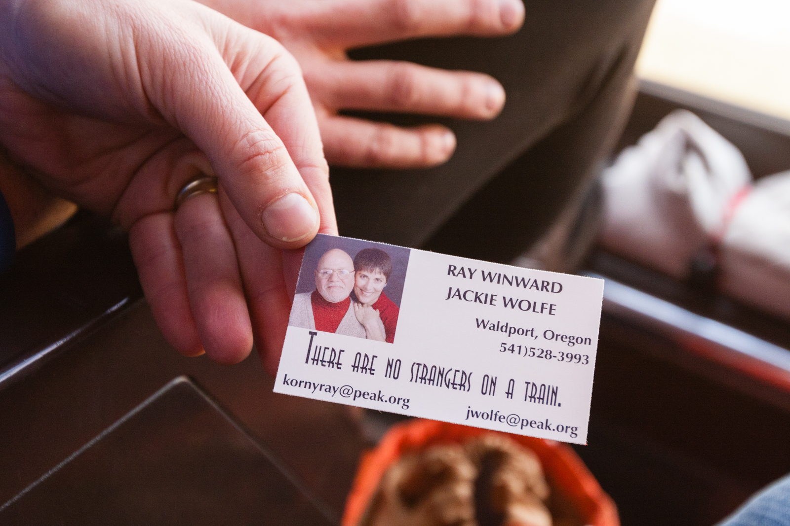
Mr. Kinsinger, the Amish butcher, had remarked in astonishment: “I met a man who said he spent 12 hours on an airplane, sitting right next to someone, and they never said a word to each other!” A former New York City cop-turned-massage-therapist from Oregon, who had ridden the Zephyr with her husband, carried cards printed with their contact information, and the headline: “There Are No Strangers on a Train.”
Abraham Lincoln’s idealism about the first transcontinental railroad’s forging national unity may have been bound up in political pragmatism and economic ambition, but a core sentiment remains true: as a train crosses borders, the boundaries between its riders dissolve. Those crosshatched lines on the map stitching the country together are also a metaphor. I witnessed community and saw everybody cherishing it.
At least for now, train travel remains in what the former flight attendant I met called an “age of innocence,” by which she meant that you can keep your shoes on to board. It is a relapse into a simpler time.
With some cash, Amtrak could add modern amenities like Wi-Fi and still preserve that slower pace that makes train travel a salve for our modern psyche, the perpetual motion lulling the rider to stillness, like a rocking cradle, and that hushing sound: choo-k-choo-k-choo-k-choo-k-choo-k.

In a Changing Antarctica, Some Penguins Thrive as Others Suffer
NEW YORK TIMES | Global warming and the Adélie penguin.

Adélie penguins in Cape Royds, home to the southernmost colony of penguins. Credit: Andy Isaacson
FIRST PUBLISHED IN THE NEW YORK TIMES, MAY 9, 2011
ROSS ISLAND, ANTARCTICA— Cape Royds, home to the southernmost colony of penguins in the world, is a rocky promontory overlaid with dirty ice and the stench of pinkish guano. Beyond the croaking din of chicks pestering parents for regurgitated krill lies the Ross Sea, a southern extension of the Pacific Ocean that harbors more than one third of the world’s Adélie penguin population and a quarter of all emperor penguins, and which may be the last remaining intact marine ecosystem on Earth.
The penguin colony is one of the longest-studied in the world. Data on its resident Adélie penguins was first acquired during the 1907-9 expedition of Ernest Shackleton, the eminent British explorer, whose wooden hut stands preserved nearby. “This is penguin nirvana,” David Ainley, an ecologist with the consulting firm H. T. Harvey and Associates who has been studying Ross Sea penguins for 40 years, said on a morning in January. “This is where you want to be if you’re a pack ice penguin.”
Of the species that stand to be most affected by global warming, the most obvious are the ones that rely on ice to live. Adélie penguins are a bellwether of climate change, and at the northern fringe of Antarctica, in the Antarctic Peninsula, their colonies have collapsed as an intrusion of warmer seawater shortens the annual winter sea ice season.
In the past three decades, the Adélie population on the peninsula, northeast of the Ross Sea, has fallen by almost 90 percent. The peninsula’s only emperor colony is now extinct. The mean winter air temperature of the Western Antarctic Peninsula, one of the most rapidly warming areas on the planet, has risen 10.8 degrees Fahrenheit in the past half-century, delivering more snowfall that buries the rocks the Adélie penguins return to each spring to nest — and favoring penguins that can survive without ice and breed later, like gentoos, whose numbers have surged by 14,000 percent.
The warmer climate on the Antarctic Peninsula has also upended the food chain, killing off the phytoplankton that grow under ice floes and the krill, a staple of the penguin diet, that eat them, by as much as 80 percent, according to a new study published this month in The Proceedings of the National Academy of Sciences.
But in the Ross Sea a reverse trend is occurring: Winter sea ice cover is growing, and Adélie populations are actually thriving. The Cape Royds colony grew more than 10 percent every year, until 2001, when an iceberg roughly the size of Jamaica calved off the Ross Sea ice shelf and forced residents to move 70 kilometers north to find open water. (The iceberg broke up in 2006, and the colony of 1,400 breeding pairs is now recovering robustly.) Across Ross Island, the Adélie colony at Cape Crozier — one of the largest known, with an estimated 230,000 breeding pairs — has increased by about 20 percent.
Climate change has created a paradise for some pack ice penguin colonies and a purgatory for others, but the long-term fate of all Adélie and emperor penguins seems sealed, as relentless warming eventually pulls their rug of sea ice out from under them. Some scientists attribute the recent sea ice growth in the Ross Sea to the persistent ozone hole, a legacy of the human use of chlorofluorocarbons that cools the upper atmosphere over the continent, increasing the temperature difference with the lower atmosphere and equator, and over the last 30 years has delivered significantly brisker westerly winds in the summer and autumn. The warming of Earth’s middle latitudes is having a similar effect, increasing that temperature difference and sending stronger winds that push sea ice off the coast and expose pockets of open water, called polynyas, that give nesting Adélie penguins easier access to food.
Meanwhile, consumers’ appetite for Chilean sea bass (Antarctic and Patagonian toothfish) may also be benefiting Ross Sea penguins, as fishing fleets from southern nations converge on one of the last remaining refuges of the fish (Dissostichus mawsoni). A fishery in the Ross Sea that opened in 1996 and was certified sustainable in December by the Marine Stewardship Council, could ultimately serve Adélie penguins by reducing competition for Antarctic silverfish (Pleuragramma antarcticum), a sardine-size fish that the penguins and toothfish enjoy. Dr. Ainley and colleagues have reported seeing fewer killer whales in the southern Ross Sea since 2002. The whales feed on toothfish, and fewer sightings suggest that the fishery is already altering the ecosystem.
Researchers witnessed Ross Sea penguin colonies thrive during the 1970s when commercial whaling removed 20,000 Antarctic minke whales, also a food competitor of Adélies, from the penguins’ wintering area. Adélie populations eventually leveled off after 1986, after an international moratorium on whaling began (and remained static until the more recent influences of climate change). Japanese whaling of minkes resumed right after the moratorium was instituted, purportedly for science, a claim that conservation groups dispute and that has incited a confrontation in the Ross Sea between the Japanese fleet and the Sea Shepherd Conservation Society, an antiwhaling vigilante group.
“It has become difficult to separate whether the increase is due to climate change or fewer toothfish,” Dr. Ainley said. “Both factors seem to be working at the same time.”
On a chilly morning in January, the Cape Royds colony was clustered across the dark volcanic rock in crèches: month-old chicks, furry and pear-shaped with tummies full of krill, huddled near their parents as adolescent penguins, still too young to breed, acted “like teenagers trying to figure out the social scene,” in Dr. Ainley’s assessment. Their cuddly appearance is misleading, it turns out, a projection of human sentiment. “They’re really nasty to one another,” Dr. Ainley said, “and if you try to pick one up you’ll have your hands full.”
Climate models predict that the winds and sea ice will continue to increase in the Ross Sea for the next 30 to 40 years, at which time the region is expected to experience a tipping point, as rising temperatures and the waning effect of the ozone hole, now getting smaller, transform the climate into the kind now seen in the Antarctic Peninsula.
Already, that process is under way. The average summer temperature at McMurdo Station, the American research base on Ross Island, has inched up 2.7 degrees Fahrenheit in the past 30 years, records show, more than the global average. Scientists conducting longterm studies of lakes in the McMurdo Dry Valleys, Antarctica’s largest ice-free area, report that after a decade of cooling, some lakes in the Taylor Valley are now gaining heat. During this past research season the scientists recorded unprecedented lake levels caused by higher glacial runoff.
On Beaufort Island, north of Ross Island, glaciers have retreated over the rocky coastline farther than they have in 30,000 years, scientists estimate, a time before the last ice age. The receding ice has opened up more nesting habitat for the resident Adélie penguin colony, which has expanded to 55,000 breeding pairs from 40,000 in the last decade.
As the sea ice retreats, researchers expect that Adélie penguins living in the Ross Sea will be forced to shift their range farther south toward the pole. In a study between 2003 and 2005, Dr. Ainley and colleagues from PRBO Conservation Science, Stanford University, NASA and the British Antarctic Survey used geolocation sensor tags to track penguins from Cape Royds and Cape Crozier to better understand their migration patterns. Published last year in the journal Ecology, the study revealed how the penguins depart their nesting grounds in February, at the end of the austral summer, and head north on foot and ice floes to flee the protracted darkness of the Antarctic winter. They appear to stop on the sea ice about 300 miles from the boundary with open water, where they stay to forage and fatten before doubling back south to their island breeding sites ahead of the creeping northern night — an 8,000-mile journey.
By carbon-dating mummified penguin remains, researchers have been able to construct a long-term history of the Adélie in Antarctica, indicating that throughout the last ice age penguins changed their migration routes and colony locations in response to advances and retreats of the sea ice. However, their range appears to have never extended farther south of where it is currently, for the simple reason that Adélie penguins appear to need light — if only twilight — to forage and navigate, and as comfort against predators.
“Emperor and Adélie penguins have an obligatory association with sea ice,” Dr. Ainley said. “As the sea ice goes, these species will go.” The Ross Sea is projected to be the last place on Earth where sea ice will endure. But as the annual winter sea ice boundary retreats farther south, pack ice penguins may ultimately find themselves trapped behind a curtain of polar night for which they have no hardwired strategy.
Indeed, Dr. Ainley speculates, Adélie penguins face possible extinction not merely by a loss of habitat — but by an unshakable fear of darkness.

A Desert Film Festival Complete With Camels
NEW YORK TIMES | Of the honors reaped by the Steven Soderbergh epic “Che” — including a Golden Palm nomination and the best-actor award for Benicio Del Toroat last year’s Cannes Film Festival — the most surreal would have to be the white camel.
FIRST PUBLISHED IN THE NEW YORK TIMES, AUGUST 2, 2009
DAKHLA REFUGEE CAMP, Algeria--OF the honors reaped by the Steven Soderbergh epic “Che” — including a Golden Palm nomination and the best-actor award for Benicio Del Toro at last year’s Cannes Film Festival — the most surreal would have to be the white camel. That is the top award handed out by the Sahara International Film Festival, whose ceremony took place this spring in an isolated encampment baked dry by the desert sun, where the women were resplendent in colored gowns and the wearing of dark sunglasses was actually necessary.
Mr. Del Toro was planning to come, until retakes for his movie “The Wolf Man” called him to London. “He would have hallucinated,” said Alvaro Longoria, an executive producer of ‘Che,’ “ after literally dismounting the prize. (He gave back the animal before departing, receiving a camel statuette in its place.) “This is real. This is what Benicio and Steven tried to tell in the movie. It’s right here: a people fighting a war for their dignity and their land. The principles of Che Guevara are very important to them.”
The sixth annual Sahara International Film Festival claims to be the world’s only film festival held in a refugee camp, a conceit organized by filmmakers from Spain to bring attention to a political contest scarcely recognized beyond this corner of northwest Africa. Some 180,000 Saharawis, a Muslim people of Arab and Berber descent, live scattered in camps along Algeria’s border with Mauritania, exiles of a long struggle with Morocco over Western Sahara, a disputed slice of desert along the Atlantic coast abundant in fish and phosphates.
After 130 years of colonial rule, Spain abandoned Western Sahara in 1975 to Morocco and Mauritania. Morocco eventually annexed most of the territory and fought a 16-year war with the Polisario Front, a Saharawi independence movement backed by Algeria, which ended in 1991 with a cease-fire and the promise of a referendum that would allow the Saharawis a choice between independence and integration. The terms of this vote have been disputed and highly politicized ever since, while Morocco has maintained sovereignty claims over the territory, constructed a sand wall marginalizing Polisario forces to the desert hinterlands and been accused by international human rights organizations of abusing Saharawi dissidents.
“There’s definitely a historical responsibility,” said Dafne Fernández, one of a dozen Spanish actors and directors who attended the festival and who, along with her boyfriend, Carlos Bardem, and his brother Javier Bardem (who attended in 2008), has spearheaded a signature campaign to prod Spain into leading a solution to the impasse. Carlos Bardem, Pedro Almodóvar and Penélope Cruz are among the film personalities championing the Saharawi cause in Spain.
Over four days in May, Dakhla — a remote camp of 30,000 situated three hours from the Algerian town of Tindouf — became the stage for a show of solidarity and Saharawi culture. Polisario flags flapped where the logos of corporate sponsors might. Four hundred foreigners attended, most of them from Spain, and were put up in the mud-brick and tented homes of Saharawi families. Meals invariably included camel. In an amphitheater formed by sand dunes, the Spanish group Macaco joined local performers in a musical protest against what they called the sand “wall of shame.”
And each evening, after the mercury dropped from heights that limited daytime activity to drinking tea (temperatures often soar past 110 degrees), crowds of European bohemians and Saharawis assembled to watch a selection of international films projected onto a screen tacked to the side of a tractor-trailer.
Many of the films, coming from a number of countries, including Cuba and Algeria, were set in the context of struggle and oppression. Among those were “The Black Pimpernel,” a film by the Swiss director Ulf Hultberg about the 1973 military coup in Chile, and the German film “Die Welle” (“The Wave”), about the workings of totalitarian government. Screenings of foreign and Saharawi-made short films depicting refugee life evoked scenes from “Cinema Paradiso,” with enraptured audiences clapping to recognizable soundtracks and marveling at the larger-than-life portrayal of a familiar drama.
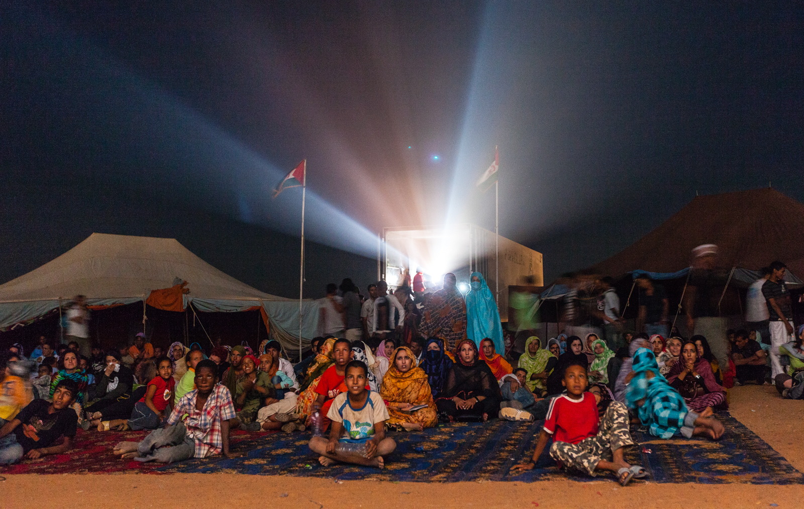
Each evening, crowds of European bohemians and Saharawis assembled to watch a selection of international films projected onto a screen tacked to the side of a tractor-trailer. Credit: Andy Isaacson
Throughout the festival, visiting instructors from film schools in Spain and San Antonio de los Baños, Cuba, taught audio-visual and storytelling workshops to young Saharawi women. With international funds, construction begins this summer on the Sahara School of Cinema, which will be located in another camp and offer a yearlong curriculum in film and television. Camps are acquiring video libraries with projectors and sound equipment.
Although these might appear to be odd luxuries for an impoverished, desert-dwelling people — the festival’s budget of 300,000 euros ($425,000) was picked up by a mix of public and private contributions — the Saharawis view filmed media as critical to their empowerment.
“The Saharawis need to express their ideas from their point of view, not just from the Europeans that come to see us,” said Omar Ahmed, the festival’s producer. “We need the tools to break out from under the information embargo that Morocco puts on us and project our culture and cause to the world.”
Meanwhile, as the United Nations this year renews attempts to broker a deal — and a growing impatience among younger Saharawi foments radicalism — the propaganda war continues. On the very same weekend, in the original Dakhla, a pleasant coastal city in Western Sahara under Moroccan control, the government there staged its own cultural festival to siphon attention from the camp. Or so the Polisario say: Morocco claims no such thing exists.